EKI’s Kat Wuelfing and Ashlee Llewellyn will be presenting at the American Water Resource Association’s (AWRA) 2016 Summer Specialty Conference GIS & Water Resources IX on July 11-13, 2016 in Sacramento, CA. Their presentation, “A Geospatial Approach to Evaluating and Targeting Water Conservation Programs” will discuss the geospatial analysis component of the data-intensive pilot study EKI conducted for the Solano County Water Agency (SCWA) and how it was an integral part in the development of recommendations for more strategic and cost-effective implementation of SCWA’s conservation programs.
We have provided below conference and topic details for more information.
Wednesday, July 13 – Session 33: Data Development and Assessment I, 1:50 pm, Tahoe Room (Hilton Sacramento Arden West)
Presentation Summary:
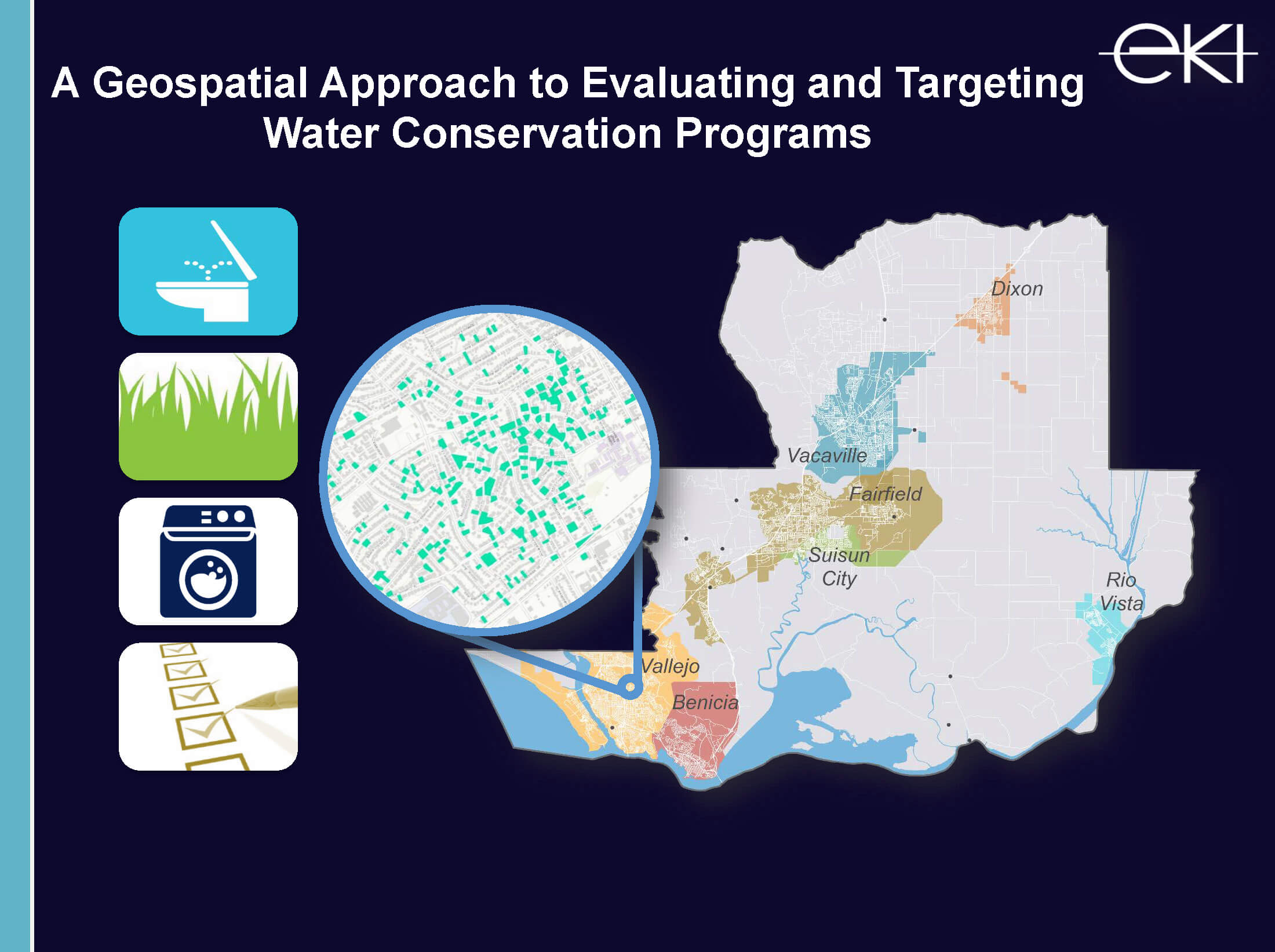 Together with Solano County Water Agency, EKI conducted a pilot study examining single-family residential (SFR) water use, the water conservation savings actually achieved from the implementation of specific water conservation programs, and the remaining water conservation potential. Geospatial analysis was a principal component of this study, aiding in both the assessment of past conservation program participation and the formation of recommendations for future conservation program activities.
In this data-intensive study, we gathered and processed a variety of data types, including account-level water use for a 15-year period, conservation program implementation records, and parcel-level housing and lot characteristics, among others. Using the City of Vallejo as our pilot test case, we developed and refined methodologies for analyzing SCWA’s four major water conservation programs: (1) High-Efficiency (HE) toilet rebates, (2) HE washer rebates, (3) turf replacement rebates, and (4) residential water use surveys. We evaluated participation in each of the conservation programs at both a county-wide level and at a more detailed city-specific level for the City of Vallejo. Spatial analyses performed included evaluating temporal trends and conducting a cluster analyses of program participation. In order to understand and evaluate the remaining conservation potential within the City of Vallejo, a multi-criteria analysis was performed for each conservation program, which incorporated a variety of program-specific water use-influencing factors and the results of the cluster analyses. From this analysis, we were able to provide SCWA with a roadmap for targeted implementation of these conservation programs in the future.
The geospatial analysis component of this study was integral in the development of recommendations for more strategic and cost-effective implementation of SCWA’s conservation programs in the future.
For questions on this presentation, contact our Burlingame headquarters at 650-292-9100

Kat Wuelfing

Ashlee Llewellyn, GISP